It is really exciting to receive the World Future Foundation PhD Prize in Environmental and Sustainability Research for the AY2010/2011. I would like to thank the World Future Foundation for their generous support in the field of environmental studies.
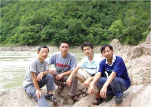
My PhD research concentrated on how to estimate suspended sediment concentration (SSC) of turbid rivers. SSC is a critical parameter in the study of rivers (e.g., water quality, nature hazards, bank erosion, river navigation, etc.). However, traditional measurements of sediment through in-situ sampling in rivers are expensive and time-consuming to perform. This is particularly true for the rivers flowing through a large mountainous region with tough transportation conditions. For example, during our arduous 45 days of field survey along the upper reaches of the Mekong River and the Red River in 2007, it was a big challenge even to find an access to the river from the road 30 meters away at some sites. Thus, these conventional methods cannot provide spatially and temporally continuous sediment records.
Therefore, my PhD research focused on how to retrieve SSC of turbid rivers from satellite data with wide spatial coverage and high temporal repeatability. Although satellite remote sensing has been applied to estimate the SSC of sea waters as well as low turbid inland waters like lakes and short river reaches in previous studies, rivers, especially highly turbid large rivers, have largely been ignored.
I investigated the relationship between spectral data and SSC through both field surveys and analysis of satellite spectra data. It was demonstrated that SSC could be estimated relatively accurately from spectral data in turbid river waters if appropriate SSC indicators were used, even when some crucial influencing factors were unknown. Furthermore, using the Yangtze River as a study river, I found that spatial distribution and temporal variations of SSC could be mapped out from satellite images directly. This helped improve the watershed management such as monitoring illegal sand dredging in river channels, and understand dynamic changes of SSC in a river system due to climate change and human activities.
It is a great honour to win the prize. The prize will certainly hearten more students in Singaporean universities to work on environmental and sustainability research. Indeed, there exist numerous “hot” environmental problems in Asia. We, the NUS students, are able to make our contributions to sustainability efforts in Singapore and Asia. For instance, unresolved debates exist with respect to the possible impacts of the Chinese dams at the Upper Mekong River on the sediment downstream. Such debates may be attributed to the extreme lack of long-term and frequent sediment measurements in the Lower Mekong River. Based on the results of my PhD research, it is possible to estimate SSC of the Lower Mekong River waters from the satellite spectral data that are increasingly available. As a student of NUS, I am very happy that my PhD research is helpful. I expect more NUS students to choose environment and sustainability as their PhD topics. I believe that they will do better than me.
– Dr Wang Jianjun