Background
My PhD research project, “Living in a watershed: the role of traditional and local practices”, aims to understand the traditional/local practices that are beneficial for the management of the watershed area of the Kuang Si Waterfall, as well as how these practices can be retained in the future. It uses a participatory action research approach whereby villagers co-identify debatable or contestable traditional/local practices and subsequently co-examine these practices through field experiments/data collection. This methodological approach not only recognises that a researcher’s relationship with the researched is bi-directional, but also legitimises my presence in the villages to do extended participant-observation in order to understand the daily lives of the villagers.
The two villages that I am focussing on are Thapene village and Nong Khuay village, from May 2019 – May 2020. This report is focussed on describing the data collection at Nong Khuay village. Mr Siphanh Daovongdeuan[1] assisted me with most of the fieldwork at Nong Khuay village.
Introduction
From June-September 2019 onwards, I conducted participant-observation in Nong Khuay village. The objective was to find out what are the traditional/local practices that are beneficial for watershed management. Participant-observation was in the form of: helping to do weeding in 3 fields (a swidden rice field, a dry paddy rice field, and a coffee farm); and helping to coordinate a volunteer project regarding improving the village’s water supply system. I also had conversations with the village leaders and villagers to become familiarised with the hydrology of the village (e.g. location of streams and sinkholes), to understand how the village protects their water bodies, and how households obtain and manage their drinking water: for example, some households boil water to remove the calcium deposits before drinking, and some houses are located farther away from communal water taps hence have more difficulty accessing water.
From this, the following ware identified as the village’s traditional/local practices that are beneficial for watershed management:
- Forest protection area around the nam lin (village water source) (Figure 1)
- Area zoned as protection area for about 12 years already, since the village water source was constructed
- Benefits to watershed: Protects water quality (nutrient uptake, reduces erosion), increases infiltration
- Riparian forest buffer zone along streams
- Technically, this is supposed to be of 50m width on each side of a water channel. However, this was not observed along for most of the length of the two major streams (Huay Luang and Huay Hia) in Nong Khuay village. (See for example Figure 2.) Given that the streams were quite narrow (e.g. less than 1m in width at some points), as well as the need for agricultural land, it would not be practical for this technical requirement to be followed.
- Benefits to watershed: Protects water quality (nutrient uptake, reduces erosion), increases infiltration, stores water
- Leaving weeds on the ground as mulch / ground cover (Figure 3)
- This was practised in the coffee farm and the swidden rice field. However, it was not practised on the dry paddy rice field.[2]
- Benefits to watershed: Reduces evaporation, reduces erosion
- ‘Gentle on soil’ upland rice farming (ເຮັດ ໄຮ່): no tilling, no compaction, no pulling out of roots, leaving the tree stumps alive (Figure 4)
- This was practised in the swidden rice field, and is the touted by some reports as the environmental benefit of swidden cultivation.
- Benefits to watershed: Increases soil moisture, increases infiltration, reduces erosion/landslips
Given that the village is mainly agricultural and is located in the watershed area of the Kuang Si Waterfall, and given that 2019 was an exceptionally dry year with little rain due to El Nino, I narrowed down the focus of the participatory research to the third and fourth traditional/local practices about soil-water interactions, i.e. about having ground cover and about no tilling/compaction of the land. They were worth further investigation because they were not uniformly practised in the village.
In early-October, we set up a Villager Research Team (VRT) comprising villagers under 35 years old (2 Khmu women and 2 Hmong women). A workshop was conducted with the VRT, during which we agreed on the hypothesis, explained the intended methods and sought inputs about the sampling sites.
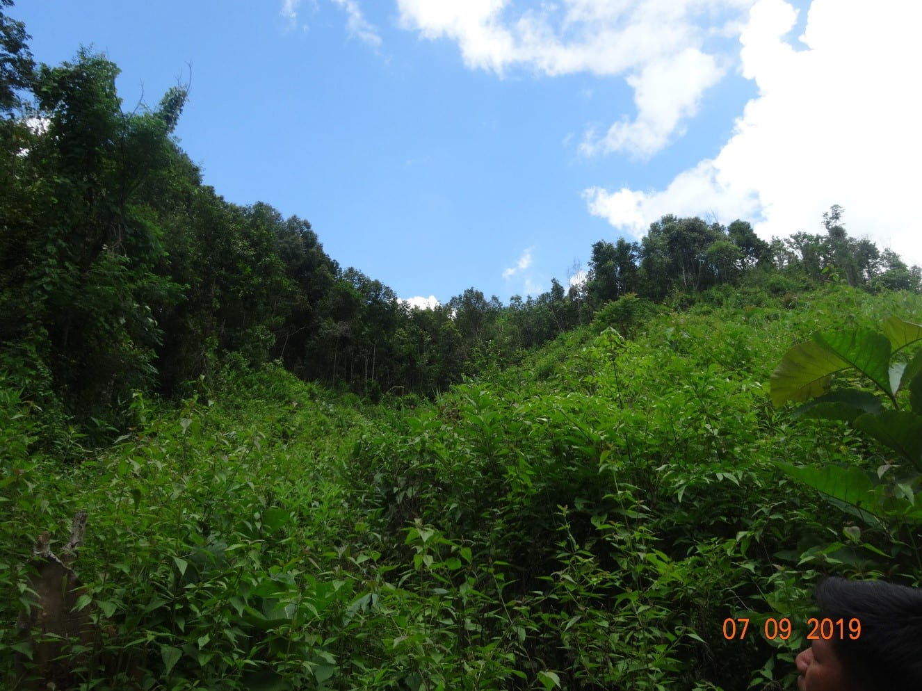
Figure 1: Forest protection area around the nam lin (village water source)
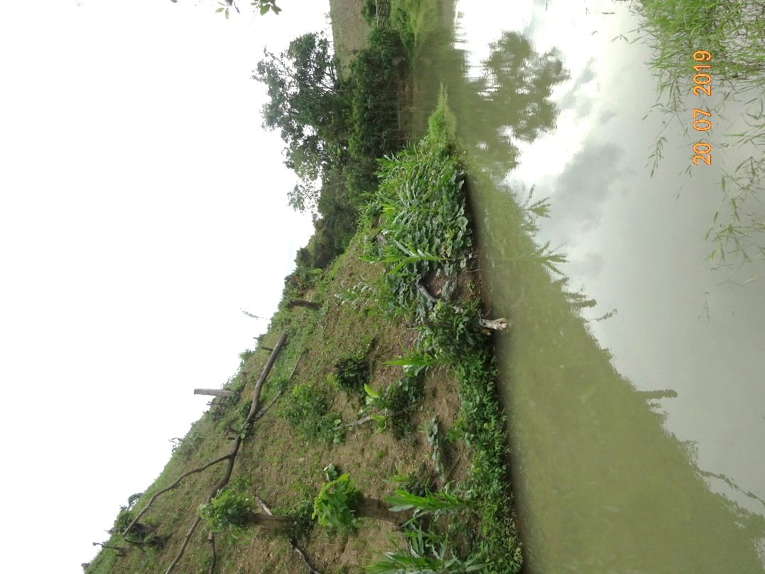
Figure 2: A steep, cleared swidden field next to the Huay Hia stream.
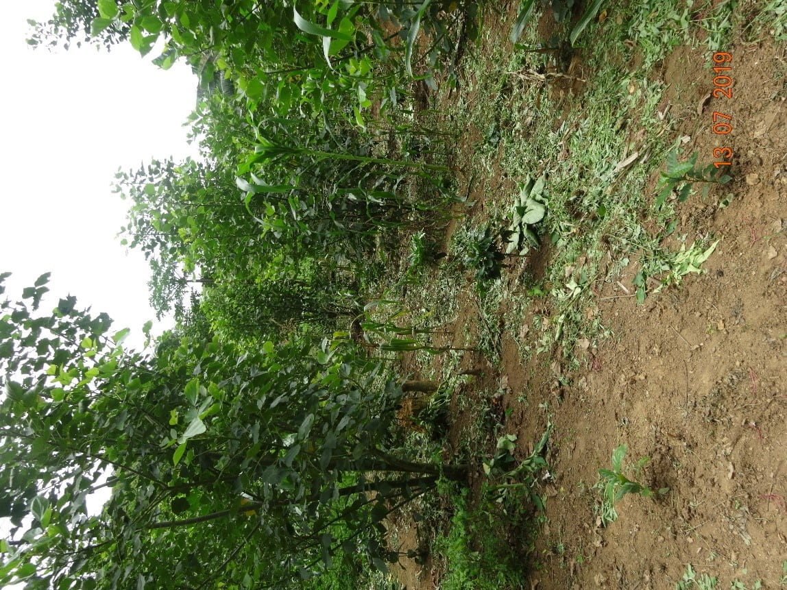
Figure 3: Leaving weeds on the ground as mulch / ground cover at a coffee farm
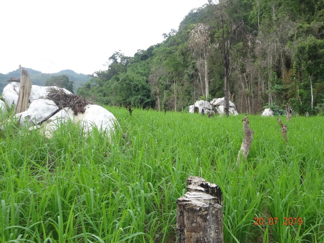
Figure 4: Swidden rice farming (ເຮັດ ໄຮ່) that is gentle on the soil: no tilling, no compaction, no pulling out of the weeds’ roots, and leaving the tree stumps alive.
Hypothesis
The hypothesis that was identified was: “Having ground-cover and the no-tilling of soil help to: (a) conserve soil moisture, (b) reduce erosion and (c) improve soil fertility.”
To investigate this hypothesis, we would need to compare various soil properties between various existing land cover/land management practices over time (see Figure 5).[3] The soil properties were: soil infiltration rate (as a proxy for soil erosion, since data collection started at the end of the rainy season), soil moisture, soil inorganic nitrates and soil texture.[4] The existing land cover/land management practices compared were:
- a vegetable garden,
- a regenerating bush fallow (ປ່າເລົ່າ),
- a swidden rice field (ໄຮ່),
- a dry paddy rice field, and
- a forest.
Data collection was conducted from early-October 2019, which was towards the end of the rainy season, until early-March 2020, which was in the middle of the warm and dry season.
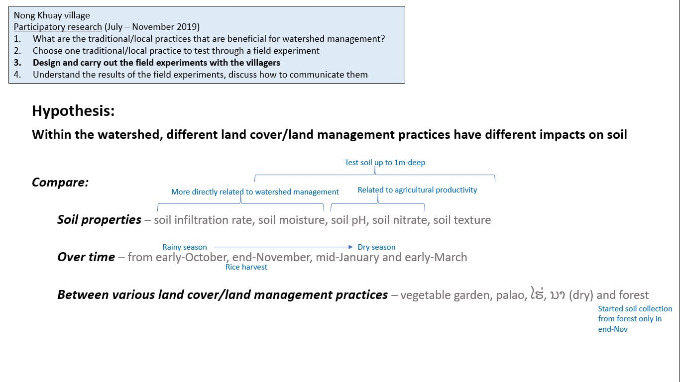
Figure 5: The objectives of the participatory research.
Methods
The sampling sites chosen are shown in Figure 6. They are chosen to be around the same area so that the underlying geology would be the same. Each sampling site represents a type of land cover/land management practice, summarised in Table 1.
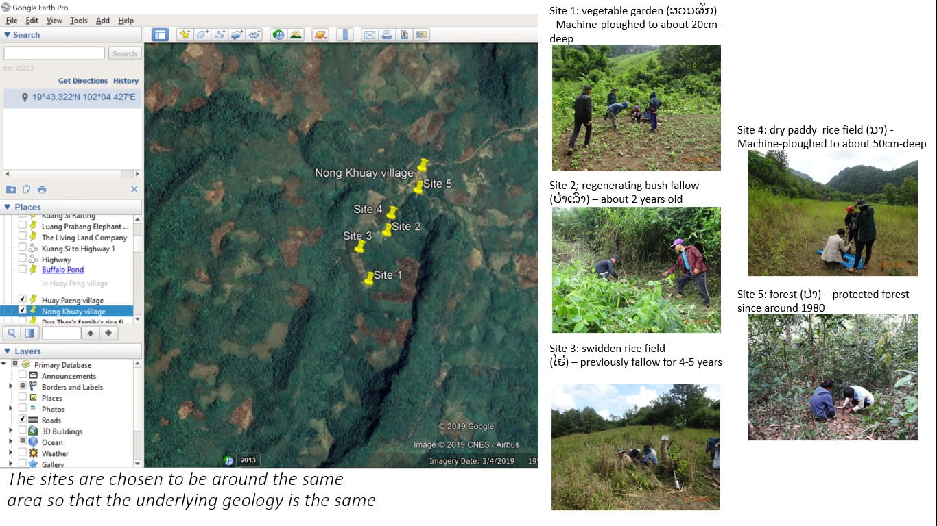
Figure 6: Locations of the sampling sites.
| Site number | Land cover/land management practice | Have ground cover? | No-tilling? |
| 1 | Vegetable garden
– machine-ploughed to about 20cm deep |
No | No |
| 2 | Regenerating bush fallow
– about 2 years old |
Yes
(dried leaves and some small plants) |
Yes |
| 3 | Swidden rice field
– previously fallow for 4-5 years |
Yes
(weeds are left on the ground during weeding; dried rice straw after rice harvesting) |
Yes |
| 4 | Dry paddy rice field
– machine-ploughed to about 50cm deep |
No | No |
| 5 | Forest
– protected since the 1980s |
Yes
(dried leaves and some small plants) |
Yes |
Table 1: Sampling sites, the corresponding land cover/land management practice, whether they have ground cover and whether they are a no-tilling site.
Table 2 lists the methods used for investigating each soil property. Soil infiltration tests were conducted with the VRT conducted at-site (Figure 7). Using a soil augur borrowed from the National University of Singapore, we collected soil samples up to 1m deep, with each sample representing a depth of 10cm or 20cm. We made sure to collect soil samples from each site at the same time of the day, e.g. we always collected samples from Sites 1, 3 and 5 in the morning and samples from Sites 2 and 4 in the afternoon. Soil moisture and soil nitrate tests were done on these soil samples in the soil laboratory of the Northern Agriculture & Forestry College (NAFC), within 1.5 weeks of sampling (Figure 8). Soil texture experiments were either conducted in the village meeting house with the VRT (Figure 9) or at the NAFC soil laboratory within 1.5 weeks of sampling. An additional soil property, soil pH, was also analysed at the NAFC soil laboratory to understand the general soil characteristics and mineral availability for plants (Figure 10). Unfortunately, due to instrumentation difficulties or technical errors, not all results for soil texture, soil pH and soil nitrate from all sampling timepoints could be used.
| Soil property | Type of test | Details | Conducted where/when | Sampling timepoint / Frequency of test |
| Soil infiltration | Constant head infiltration test with outer ring (double ring infiltrometer) | Measured time taken for every 50ml of water to fall in an ~7cm diameter tin can[5] | In-situ | • 5-6/10/2019;
• 23-24/11/2019; • 11-12/1/2020; • 29/2-1/3/2020 |
| Soil moisture | Gravimetric method | Sample placed in oven at 60°C until constant mass is reached[6] | In laboratory, within 1.5 weeks after sampling | • 5-6/10/2019;
• 23-24/11/2019; • 11-12/1/2020; • 29/2-1/3/2020 |
| Soil texture | Manipulative test | Rolling into a ball, a sausage, a semi-circle and up to a circle[7] | In village meeting house or in laboratory, within 1.5 weeks after sampling | • 23-24/11/2019;
• 11-12/1/2020; • 29/2-1/3/2020 |
| Soil pH | Mix soil with water | 40g of soil is mixed with 40ml of waters and pure water and filtered; filtrate is tested using the Horiba pocket pH meter | In laboratory, within 1.5 weeks after sampling | • 23-24/11/2019;
• 29/2-1/3/2020 |
| Soil nitrate (inorganic) | Mix soil with water | 10g of dried soil mixed with 50ml of tap water and filtered; filtrate is tested using the Horiba pocket nitrate meter | In laboratory, within 1.5 weeks after sampling | • 29/2-1/3/2020 |
Table 2: Methods for investigating each soil property.
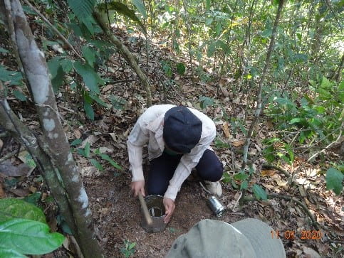
Figure 7a: Setting up the soil infiltration experiment in the forest (Site 5).
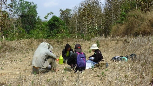
Figure 7b: Conducting the soil infiltration test in the dry paddy rice field (Site 4).
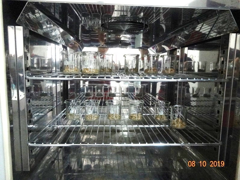
Figure 8: Measuring soil moisture using the gravimetric method using the oven at the soil laboratory of the Northern Agriculture and Forestry College.
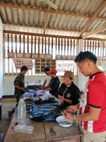
Figure 9: Evaluating soil texture using the manipulative test at the village’s meeting house with members of the VRT.
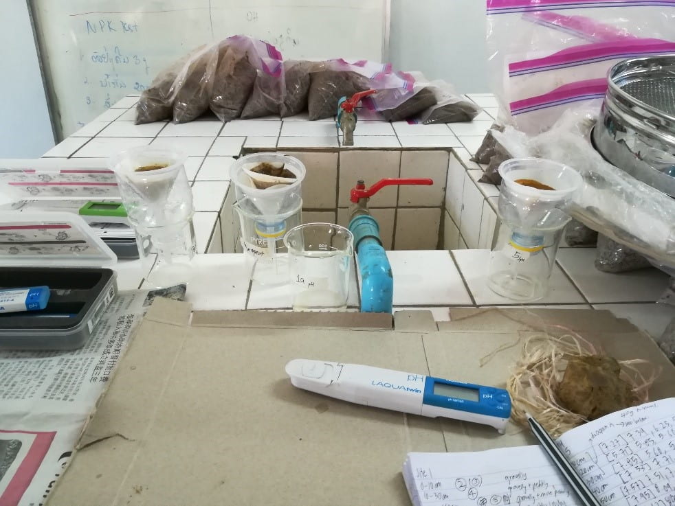
Figure 10: Measuring soil pH using the Horiba pocket pH meter at the soil laboratory of the Northern Agriculture and Forestry College.
Findings
- General characteristics:
1a. Rock type
Pieces of rock were obtained from the soil samples. There were chalky pieces of rock from Site 1, Site 2, Site 3 and Site 4. However, rock pieces from Site 5 resembled charcoal (Figure 11).

Figure 11: Rock pieces from the soil samples.
1b. Soil pH
At all 5 sites, soil pH ranged from 7 – 8.5 (Figure 12). This was consistent with the geology of Nong Khuay village being karstic (i.e. high limestone content). The lower pH at the 0-10cm depth of soil could be because of decomposition of organic matter at the soil surface. In general, there is not much difference between sites, showing that geology plays a bigger role in determining soil mineral availability for plants.

Figure 12: Soil pH for the five sites, for the two sampling timepoints of 23-24/11/2019 and 29/2-1/3/2020.
- Soil moisture
In terms of the hypothesis of “Having ground cover and/or no-tilling conserves soil moisture more than not having ground cover and/or tilling”, our comparison (Figures 13-15) revealed that although the Sites 2, 3 and 5 are categorised as having both ground cover and/or no-tilling, the soil moisture characteristics of Sites 2 and 5 are different from those of Site 3. This is likely because Sites 2 and 5 have more forested/shaded conditions than Site 3.
In general, Sites 2 and 5, compared to the no-ground-cover and tilled sites of Sites 1 and Site 4, are able to conserve more soil moisture for each sampling timepoint for the entire 1m-deep soil profile. Compared to Site 1, Sites 2 and 5 were able to conserve soil moisture over time. For Site 4, soil moisture did not change much over time, though this is likely because Site 4 already started off very dry, at only 10% soil moisture in November 2019.
On the other hand, soil moisture characteristics for Site 3 were not very different from Site 1 and Site 4. However, compared to Site 1, there was little change over time for the deeper layers (80cm-100cm), though this could be because this deep layer of Site 3 was already quite dry to start with, at 10-15% soil moisture from October 2019.
The above observations suggest that:
- Shade/tree cover plays a role in preventing evaporation from soil
- Sites 2 & 5 have tree shade; Site 3 does not
- The thickness and density of ground cover makes a difference in soil moisture retention
- Sites 2 & 5 have leaf litter; Site 3 has dried rice straw

Figure 13: Soil moisture for Site 2 (top), up to 1m in depth, for the 4 different sampling timepoints. Soil moisture for Site 5 (bottom), up to 1m in depth, for 3 different sampling timepoints.
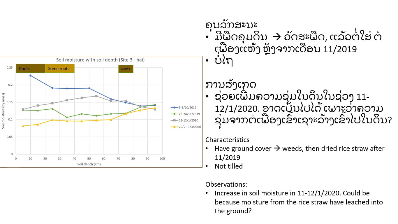
Figure 14: Soil moisture for Site 3, up to 1m in depth, for the 4 different sampling timepoints. Interestingly, there is an increase in soil moisture in the 11-12/1/2020 sampling timepoint. As this sampling was done after the rice harvest, a possible reason could be that moisture from the rice straw has leached into the ground.
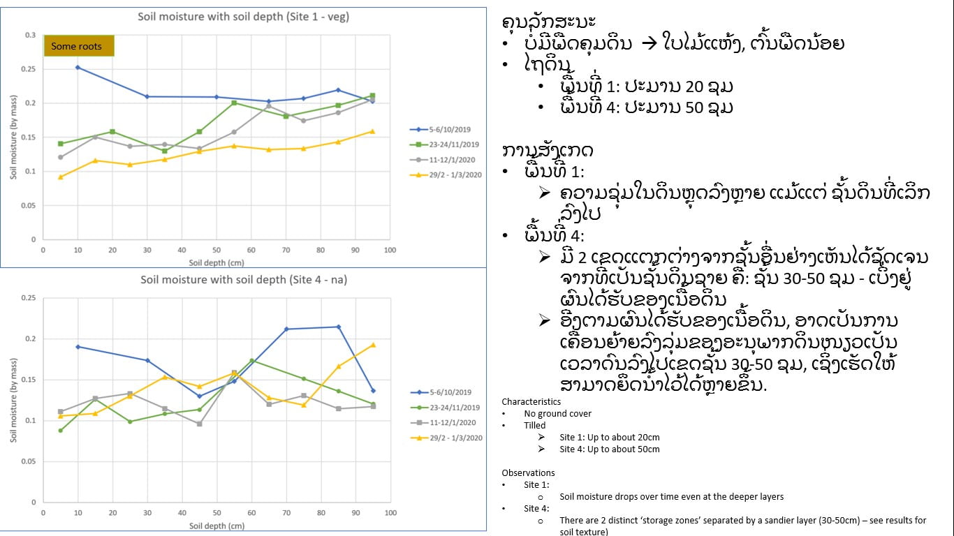
Figure 15: Soil moisture for Site 1 (top) and Site 4 (bottom), up to 1m depth, for the 4 different sampling timepoints. For Site 1, soil moisture drops over time even at the deeper layers. For Site 4, there appears to be 2 distinct ‘storage zones’ separated by a sandier layer at around 30-50cm depth.
- Soil erosion / soil loss
We used soil infiltration rate as a proxy for soil erosion / soil loss. This is based on the model that higher soil infiltration rate translates to less surface runoff, which then means lesser mobilisation of surface soil particles by the surface runoff. In the method used to measure soil infiltration rates, ground cover was removed such that only the soil was exposed. Hence the relevant hypothesis investigated was “Having no-till increases infiltration rates hence reduces soil erosion / soil loss more than tilling”. No-tilling is represented by Sites 2, 3 and 5. Tilled soils are represented by Sites 1 and 4. Figures 16 and 17 show the soil infiltration curves for the 5 sites for 100mm of water to infiltrate into the ground.
Comparing Sites 2, 3 and 5 with Site 4, the results show that no-tilling does increase the infiltration rate. At Site 4, it could take up to 40 minutes for the 100mm of water to infiltrate into the soil.
On the other hand, when the soil infiltration rates for Sites 2, 3 and 5 are compared with Site 1, the hypothesis is disputed. Soil infiltration rates for Sites 2 and 5 were comparable with Site 1 in November 2019; however, although Sites 2 and 5 had a higher soil moisture content than Site 1, their soil infiltration rates were higher than Site 1 in the January 2020 and March 2020 field experiments. In general, soil infiltration rates were higher at Site 1 than at Site 3, although both sites have comparable surface soil moisture over time and Site 3 is slightly steeper than Site 1.
The above observations suggest that:
- Surface soil texture plays a role in influencing infiltration rates
- E.g.: Surface soil of Site 1 is sandier compared to Sites 2 & 5. Hence, there are more pore spaces in-between when it is recently-tilled. But this does not last over the months because Site 1’s surface soil gradually gets less sandy over time (refer to Figure 18), and we see that soil infiltration rates at Site 1 does not increase over time although the surface soil gets drier.
- No-tilling is associated with less compaction of surface soils, more soil pore space, and hence higher soil infiltration rates. However, this depends on what kind of tilling is done.
- E.g. the tilling done at Site 1 would have probably loosened the surface soil, with the likely intention of allowing for the roots of vegetables to grow more easily.
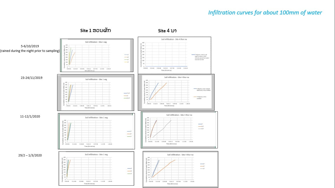
Figure 16: Soil infiltration curves for Site 1 and Site 4, for about 100mm of water to infiltrate into the ground, at various timepoints.
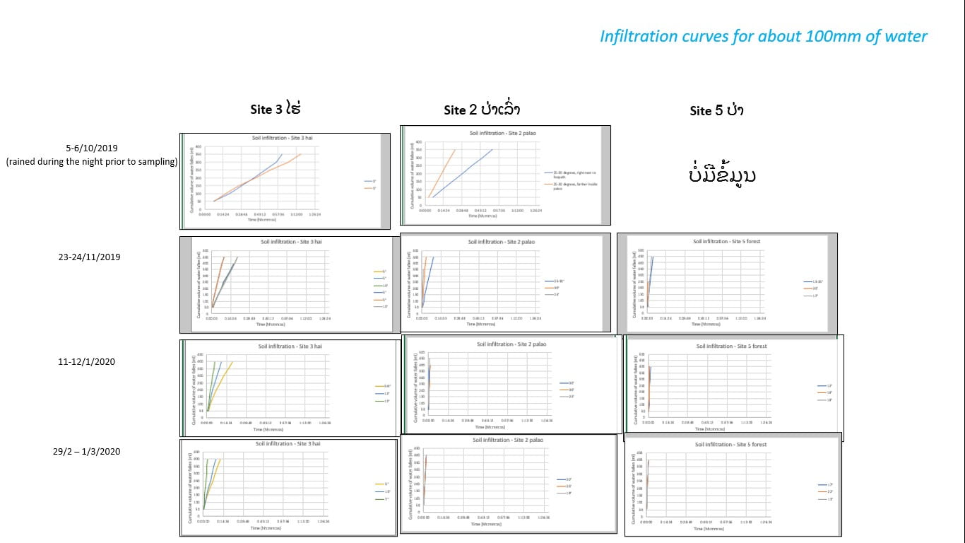
Figure 17: Soil infiltration curves for Site 2, Site 4 and Site 5, for about 100mm of water to infiltrate into the ground, at various timepoints. For Site 5, data collection only started on 23-24/11/2019.
A caveat for using soil infiltration rate as a proxy for soil erosion/soil loss is that it is only applicable for pre-saturated soils. Water-induced soil erosion is also affected by surface soil texture and the presence of ground cover. In terms of surface soil texture, sandy soils tend to be more easily mobilised and hence eroded. Of the 5 sites, the surface soil of Site 1 is sandy (Figure 18). Table 3 integrates the observations about soil infiltration, soil surface texture and ground cover at each site in a matrix. The site that we should be most concerned about water-induced soil erosion is Site 1. This is followed by Site 4: however, because Site 4 is flat and there is no exit point for water, there is little worry that any eroded soil (e.g. from raindrop impact) will be washed away.
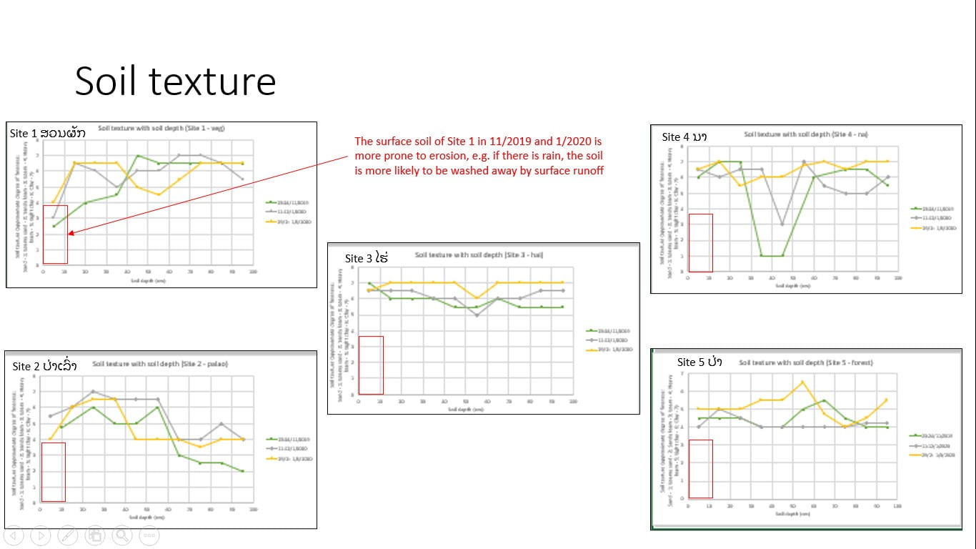
Figure 18: Soil texture analysis for the various soil samples. For the scale on the vertical axis: 1 – sand; 2- loamy sand; 3 – sandy loam; 4 – loam; 5 – heavy loam; 6 – light clay; 7 – clay. Of the 5 sites, Site 1 has surface soil with a sandier composition.
| Site | 1. Vegetable garden | 2. Bush fallow | 3. Swidden rice field | 4. Dry paddy field | 5. Forest |
| Ground cover | 🙁 | 🙂 | 😐 | 🙁 | 🙂 |
| Porosity / infiltration | 😐 | 🙂 | 😐 | 🙁 | 🙂 |
| Soil texture | 🙁 | 🙂 | 🙂 | 🙂 | 🙂 |
Table 3: Observations about soil infiltration, soil surface texture and ground cover at each site ( “:)” – favourable, “:|” – neutral, “:(” – unfavourable)
- Soil nitrates
Using soil inorganic nitrates as a proxy, the hypothesis investigated was “Having ground cover and/or no-tilling increases soil fertility more than having no ground cover and/or tilling”. Due to instrumentation issues, soil inorganic nitrates were measured only for the soil samples collected in March 2020.
Figure 19 shows the soil nitrates results for the five sites. Comparing Site 4 with Sites 2, 3 and 5, the results suggest that no-tilling and having ground cover increases soil fertility. The results from comparing Site 1 with Sites 2, 3 and 5 are more nuanced. Sites 2 and 5 had higher nitrate content in the surface soils, up to 20cm depth and 40cm depth respectively. However, the soil nitrate content in Site 3 was about the same as that of Site 1 for the 0-20cm layer of soil, and was then lower for deeper soil layers. It is noted that none of the sites had fertilisers applied to them.
The above observations suggest that:
- Land use history plays a role in determining soil fertility, not just existing land use/management
- Before Site 1 was used as a vegetable garden in 2019, corn was planted for 3 years. Prior to that, it was used as a swidden rice field for 3 years, after a 3-year fallow period. Hence, with the fallow period and re-introduction of crop residues into the soil (e.g. via green mulch), some soil nitrates could have accumulated in the soil from the past and subsequently also brought to the surface when the surface 20cm of soil was tilled. In contrast, before Site 4 was used as a rice field, it was a teak plantation for several years.
- Soil recovery time is important for soil fertility
- Site 5 is the most undisturbed, hence the soil can achieve good fertility.
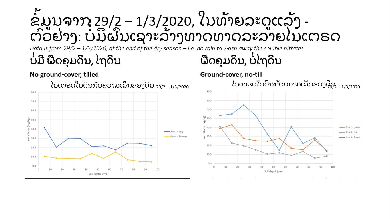
Figure 19: Soil (inorganic) nitrate content of Sites 1 and 4 (left) and Sites 2, 3 and 5 (right).
Recommendations
In terms of improving agricultural productivity at Nong Khuay village, the following two main recommendations are made:
- For farmers to recognise what they can change, and what they cannot change.
It is difficult to change soil pH. As such, farmers should choose to grow plants that can do well in alkaline soils. Soil pH can be lowered through composting/mulching, but due to the underlying geological conditions it is unlikely to go below pH 7.
Soil properties that can be changed include:
- Soil nitrogen à by growing legumes, by making compost/mulch, and by avoiding applying compost/fertilisers right before it rains to prevent leaching
- Soil porosity à by not compacting the soil
- Soil moisture à by providing shade, ground cover, etc.
- For farmers to take care of the soil to stop land degradation
Due to climate change, the weather is becoming more extreme – ranging from very hot to very cold, and very dry to heavy rains. Furthermore, if soils are exposed, they can be subject to water-induced erosion or wind-induced erosion (Figure 20), leading to more soil loss, and a vicious cycle continues (Figure 21). The following insights about soil management from this study’s findings are also instructive for doing climate-smart agriculture:
- Not simply about ‘tilling versus no-tilling’ or ‘ground-cover versus no-ground-cover’
- Farmers should pay attention to how the tilling is done (e.g. how much to compact the soil?) and the type of ground cover
- Conserving soil moisture
- Methods include:
- Shading from trees; ground-cover; etc.
- When there’s no rain, trees/bushes can help to trap mist (e.g. Figure 22)
- Methods include:
- Preventing erosion
- Important because it is also about conserving good-quality soil
- Factors to consider: soil infiltration/porosity; surface soil texture
- Desirable soil properties
- Forest soil seems to be most ideal, but requires recovery time
- We need to think about how we can recreate similar conditions for farmlands, within a shorter timespan
Figure 20: Video showing how exposed soils could be susceptible to wind-induced erosion.
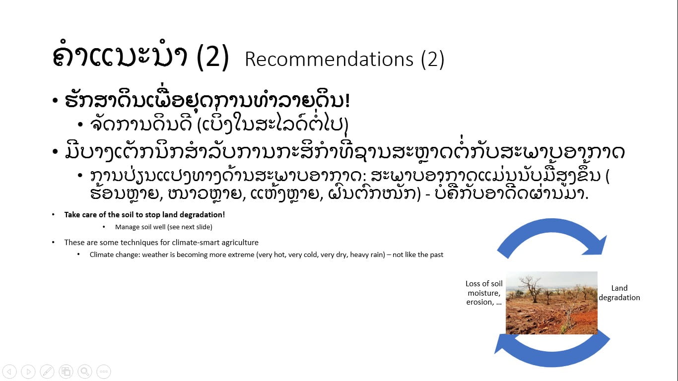
Figure 21: The vicious cycle of the land degradation and the loss of soil moisture, erosion, etc.
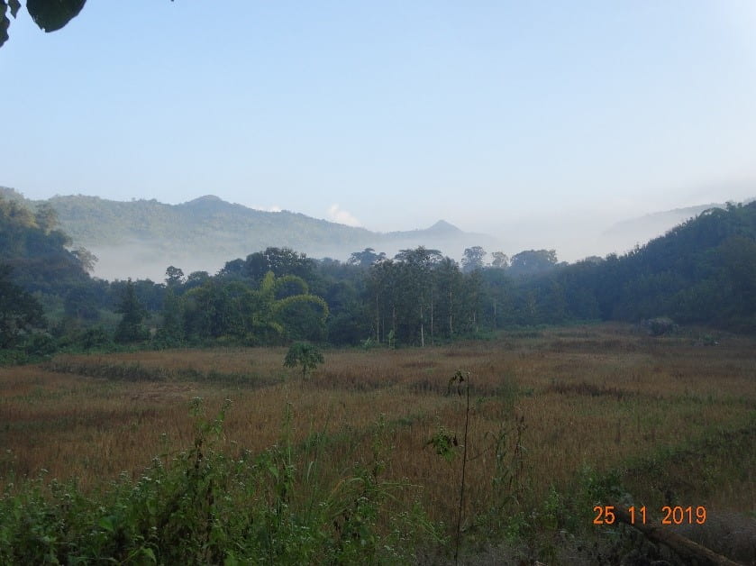
Figure 22a: A misty morning.

Figure 22b: The leaves of plants help to trap mist.
To further the study, a sixth type of land use/management practice, pasture for cattle-grazing, could be included in the future. This was not included in our initial scoping as the participant-observation phase and the workshop did not reveal any contesting or differing practices between villagers. However, given that more villagers are increasingly transitioning to cattle-raising as a more secure income source, and that cattle-raising could have negative effects on watershed health[8], there is potential to investigate this form of land use further. Scoping such a study will need to consider that cattle-raising practices could potentially differ between households.[9]
Knowledge dissemination
The findings were reviewed, and the recommendations discussed, with 3 members of the VRT in the evening of 6 May 2020.[10] The study’s main takeaways and recommendations were then shared with the village leaders in the afternoon of 7 May 2020. It would have been ideal to conduct a workshop/awareness-raising activity about soil health for all villagers; however, this was unfortunately not done due to time constraints.[11]
During the sharing session with the village leaders, village leaders also shared the following about their existing practices and challenges with regards to soil-water management in Nong Khuay village:
- Watering crops:
- If there is no rain, they will water their crops 1-2 times a day. This is mainly by using a watering can; if a hose is used, soil compaction could be faster.
- Generally, there is a shortage of water in Nong Khuay village to irrigate the crops.
- Soil fertility:
- To ‘read’ whether the existing soil is fertile, they look at the whether the natural vegetation grows well, or if the colour of the soil is black
- Generally, the land in Nong Khuay village is not fertile.
- If slash-and-burn is done, the land becomes unproductive after 2-3 years.
- The best practice to restore soil fertility is to make compost. If the agricultural area is small, manure from pigs, chickens or bats can be used to fertilise the soil. However, it is more laborious for a big plot of farmland.
Conclusion
The above findings point out that the hypothesis of “Having ground-cover and the no-tilling of soil help to: (a) conserve soil moisture, (b) reduce erosion and (c) improve soil fertility” is not always true. Instead, what matters for soil health is more nuanced: the type of ground-cover and how the tilling is done. The land use history of a site also affects existing the soil structure and mineral content, and rehabilitating soils take time.
Although Nong Khuay village has two main streams, these streams are small and the extent to which villagers have harnessed them is limited.[12] This means that most farmers rely on rain-fed agriculture, which then puts them at the mercy of the weather – this was witnessed during the 2019 El Nino, when many farmers expressed difficulty with their crops due to the lack of rain. To be more resilient to extreme weather conditions, it is therefore important for farmers to take care of their soils so that they can extend the productive lifespan of their fields, for example by conserving soil moisture, preventing soil loss, and ‘feeding’ the soil with compost. These climate-smart agricultural practices will also reduce the amount of sediments and the amount of nutrients that get washed downstream, therefore benefiting the health of the watershed, which is quite sensitive in the karstic environment of the Kuang Si watershed area.
Rainfed agriculture accounts for more than three-quarters of the cropped area in the world.[13] The soil-water management challenges that these villages face would not be too different from those of Nong Khuay village. From this participatory research at Nong Khuay village, I hope that international organisations, NGOs and community development organisations can incorporate into their programmes the need to raise awareness about the importance of taking care of soil health.
Acknowledgements
My fieldwork at Nong Khuay village would not have been possible without the assistance of Mr Siphanh Daovongdeuan, who displayed a positive work ethic, a sense of humour, and care for the villagers. His presence was always welcomed by the villagers, and he was adept at bridging the communicative gap between ‘educated project implementers’ like myself and rural villagers.
Many thanks also to the four members of the Villager Research Team, Ms Phonevilay Soukhy, Mr Oudom Soulimoungkhoun and Ms Sot Phetsamone for their assistance in the various phases of my fieldwork at Nong Khuay village. I would also like to express my thanks to Mr Phonthip Phongsavath and Mr Viengphet Panoudom of CHESH-Lao, and Ms Nguyen Minh Phuong of the Social Policy Ecology Research Institute (SPERI), for their important behind-the-scenes support; and to Dr Outhai and Mr Nou Yang of the Northern Agriculture & Forestry College for allowing me to use their soil laboratory. Much appreciation also goes to the village leader and villagers for generously hosting me during our numerous visits to Nong Khuay village.
Finally, I would like to acknowledge CHESH-Lao/SPERI for hosting me in Laos, the National Geographic Society for the funding support, my PhD thesis committee for providing intellectual critique, and my family for the invaluable the moral support. Without your trust, support, feedback and understanding, I would not be able to conduct my fieldwork in Laos.
=======
[1] From the Faculty of Agriculture and Forestry, Souphanouvong University, Luangprabang province
[2] The family explained during the workshop in October that they were concerned that leaving the weeds on the ground would cause the seeds to spread, thereby inadvertently propagating more weeds.
[3] An alternative approach of hypothesis-testing would have been to set up experimental plots, but this would have been more suitable if we had started in March/April to coincide with the season when farmers are planting in their field.
[4] The choice of soil properties was also guided by the equipment that was available to me.
[5] Adapted from: https://www.youtube.com/watch?v=nSGdAF6Dz9Y&t=199s
[6] Adapted from http://home.iitk.ac.in/~madhav/expt1.html and https://lter.kbs.msu.edu/protocols/24
[7] According to: http://www.fao.org/fishery/static/FAO_Training/FAO_Training/General/x6706e/x6706e06.htm
[8] See for example the following documents which mention the need to improve cattle-management practices for watershed protection:
- Malmer, A., Murdiyarso, D., Bruijnzeel, L.A. and Ilstedt, U., 2010. Carbon sequestration in tropical forests and water: a critical look at the basis for commonly used generalisations. Global Change Biology, 16: 599-604.
- FAO, 2017. Watershed management in action – lessons learned from FAO field projects. Food and Agriculture Organisation, Rome.
- Springgay, E., 2019. Forests as nature-based solutions for water. In ‘Unuasylva’ (ed. A. Sarre), Vol. 70 2019/1, Food and Agriculture Organisation (FAO).
[9] See for example: Phouyyavong, K. Tomita, S. and Yokoyama, S., 2019. Impact of forage introduction on cattle grazing practices and crop-livestock systems: a case study in an upland village in northern Laos. The Rangeland Journal. https://doi.org/10.1071/RJ18102
[10] The fourth member of the VRT had gone to his field to stay over and do farming, as his field is a few hours’ walk away. Due to time constraints, we had to proceed with the discussion without him.
[11] This blog article (https://blog.nus.edu.sg/doyouloveourearth/2020/09/16/fieldwork-against-the-backdrop-of-covid-19/) explains how covid-19 had limited on the amount of time that I could spend at Nong Khuay village.
[12] At certain points of the Huay Hia stream, some villagers have diverted the water to make fish ponds. Water is also diverted away from the Huay Luang stream to irrigate a few fields. However, these villagers are lucky in the sense that their fields are located in the right topography: due to the high cost of pumps and pipes, fields at higher elevations are not irrigated. As far as I understand from my fieldwork, there is as yet no system in Nong Khuay village to regulate agricultural water distribution.
[13] Reddy, V.R. and Syme, G.J., 2015. ‘Introduction’ in Integrated Assessment of Scale Impacts of Watershed Intervention: Assessing Hydrogeological and Bio-physical Influences on Livelihoods. Elsevier.
Recent Comments